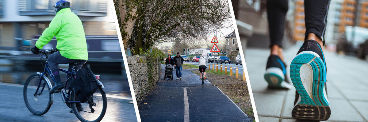
It is the ambition of Cumbria County Council to get more people cycling and walking in Cumbria and that cycling and walking should be the natural choice for everyday short journeys. Cycling and walking more often is good for our health and wellbeing, the environment and the local economy.
During the height of Covid-19, less traffic on our roads resulted in cleaner air and quieter streets, transforming the environment in our towns and city. Because of this, lots of people discovered, or rediscovered, cycling and walking as a means for exercise and travel. We now have an opportunity to help maintain this interest and ensure people have the choice to take short journeys on foot or by bike, rather than use their cars. The proven way of encouraging more of us to walk and cycle is by providing routes that are coherent, direct, safe, comfortable and attractive.
To encourage cycling and walking, the County Council has established a Cycling and Walking programme to identify, develop and secure funding to deliver infrastructure improvements. A key component of this programme is the development of Local Cycling and Walking Infrastructure Plans (LCWIPs) which identify and prioritise future improvements to the local cycling and walking network over the next 15 years (2022-2037). LCWIPs have been developed in Barrow in Furness, Carlisle, Kendal, Workington, Whitehaven and Penrith.
Strategic Corridors Public Consultation (1 April to 22 April 2022)
We held a consultation on proposals to improve the cycling and walking offer along two key 'strategic corridors' within Cumbria; the Hadrian's Wall and West Coast corridor and the Heart of the Lakes corridor.
This consultation focussed on gaining feedback on:
- The purpose of cycling and walking trips currently undertaken in the corridors and any barriers faced.
- Proposals presented for the Heart of the Lakes strategic corridor/ See More Lake District Cycling project, including prioritisation of proposals
- Proposals presented for the Hadrian's Wall and West Coast strategic corridor/ Hadrian's Wall Cycling and Walking Corridor project, including options for route alignment
The consultation is now closed and we thank everyone who took the time to respond for their feedback.
We have analysed the responses and the results are provided in the Summary Report below.
Strategic Corridors Consultation Summary Report (PDF 5.4MB)
Consultation Document:
Strategic Corridors Consultation Document (PDF 7MB)
Local Cycling and Walking Infrastructure Plans (LCWIPs) Public Consultation
Public and stakeholder engagement has played a key part in the development of the Local Cycling and Walking Infrastructure Plans (LCWIPs) for Barrow-in-Furness, Carlisle, Kendal, Penrith, Whitehaven and Workington. The Council have undertaken two rounds of public consultation to ensure that the proposed networks connect people to the places they want to get to.
LCWIPs are not funded plans however, the ability to demonstrate support for the plans is particularly important for future funding bids.
Both consultations are now closed and we thank everyone who took the time to respond for their feedback.
Initial Public Consultation - Barrow in Furness, Carlisle and Kendal (7 May to 28 May 2021) and Penrith, Whitehaven and Workington (14 July to 6 August 2021)
The initial public consultation focused on gaining an understanding of:
- Current travel behaviour - cycling and walking journeys and why these are undertaken;
- Public opinion on the current active travel provision;
- Any barriers on active travel routes that may prevent cycling and walking;
- What would encourage modal shift to cycling or walking for short journeys; and,
- Feedback on the emerging prioritised cycling network
We have analysed the responses and the results are provided as Full and Summary Consultation Reports below.
- Barrow in Furness Initial Consultation Report (Full) (PDF 4MB)
- Barrow in Furness Initial Consultation Report (Summary) (PDF 1MB)
- Carlisle Initial Consultation Report (Full) (PDF 4MB)
- Carlisle Initial Consultation Report (Summary) (PDF 1MB)
- Kendal Initial Consultation Report (Full) (PDF 4MB)
- Kendal Initial Consultation Report (Summary) (PDF 1MB)
- Penrith Initial Consultation Report (Summary) (PDF 1MB)
- Penrith Initial Consultation Report (Full) (PDF 5MB)
- Whitehaven Initial Consultation Report (Summary) (PDF 5MB)
- Whitehaven Initial Consultation Report (Full) (PDF 3MB)
- Workington Initial Consultation Report (Summary) (PDF 884KB)
- Workington Initial Consultation Report (Full) (PDF 2MB)
Consultation documents:
- Barrow in Furness Consultation Document (PDF 2.8MB)
- Carlisle Consultation Document (PDF 2.5MB)
- Kendal Consultation Document (PDF 2.7MB)
- Penrith Consultation Document (PDF 12MB)
- Workington Consultation Document (PDF 15MB)
- Whitehaven Consultation Document (PDF 11MB)
Follow up Public Consultation - Barrow in Furness, Carlisle, Kendal (5 November to 26 November 2021) and Penrith, Whitehaven and Workington (4 February to 25 February 2022)
The follow up public consultation provided a second chance to comment on the updated draft priority cycling and walking networks, prior to the LCWIPs being finalised. This consultation focussed on:
- Gauging the level of support for the draft prioritised cycling and walking network plans;
- Whether the network and interventions proposed would encourage the respondent to use active modes more often; and,
- Whether there was support for reduced space for cars to prioritise active modes.
We have analysed the responses and the results are provided in the Summary Consultation Reports below.
- Barrow-in-Furness Follow-up Consultation Report (PDF 1.7MB)
- Carlisle Follow-up Consultation Report (PDF 2MB)
- Kendal Follow-up Consultation Report (PDF 1.5MB)
- Penrith Follow-up Consultation Report (PDF 2MB)
- Workington Follow-up Consultation Report (PDF 3MB)
- Whitehaven Follow-up Consultation Report (PDF 3MB)
Consultation documents:
Overview
It is the ambition of Cumbria County Council to get more people cycling and walking in Cumbria and that cycling and walking should be the natural choice for everyday short journeys.
During the height of Covid-19, less traffic on our roads resulted in cleaner air and quieter streets, transforming the environment in our towns and city. Because of this, lots of people discovered, or rediscovered, cycling and walking as a means for exercise and travel. We now have an opportunity to help maintain this interest and ensure people have the choice to take short journeys on foot or by bike, rather than use their cars.
Cycling and walking more often is good for our health and wellbeing, the environment and the local economy. Increased physical activity can lead to a happier healthy lifestyle. Cycling is a great fun form of low-impact exercise, so it's easier on your joints, particularly your knees. Walking is one of the easiest ways to get more active, its simple, free and even a short brisk daily walk brings lots of health benefits. These health benefits aren't just physical, getting active outdoors and enjoying the fresh air can have a positive effect on your mental health and wellbeing. Choosing to take a journey by bike or by foot has benefits for the environment too. Cycling and walking has a lower carbon footprint compared to other forms of transport. Together we can all contribute to the Zero Carbon Cumbria Partnership's target to become the first carbon-neutral county by 2037.
The proven way of encouraging more of us to walk and cycle is by providing safe, attractive and convenient cycling and walking routes. These routes need to be designed to be inclusive, so people of all ages and abilities can get around conveniently, confidently, and safely. Implementing a network of high-quality routes requires the following five design principles to be applied. Routes should be:
- Coherent - part of a wider strategic network that provide access to key destinations
- Direct - reach their destination as directly as possible
- Safe - of a high quality and designed to standards that meet safety requirements
- Comfortable - accessible and attractive for all abilities
- Attractive - contribute to good urban design by integrating with and complementing their surroundings.
In 2017 Cumbria County Council, together with Cumbria's district councils, national parks, cycling bodies and highways partners endorsed the Cumbria Cycling Strategy. The Strategy sets the context for the development of cycling in Cumbria. A key objective is to improve the county's infrastructure and Cumbria County Council is committed to taking the lead on this aspect.
To encourage cycling and walking, the County Council has established a Cycling and Walking Programme to identify, develop and secure funding to deliver infrastructure improvements. The development of Local Cycling and Walking Infrastructure Plans (LCWIPs) is central to achieving the objective of improving the county's cycling and walking networks. This focusses on short journeys in Cumbria's urban areas, where most of these local trips take place. LCWIPs are currently being developed in Barrow in Furness, Carlisle, Kendal, Workington, Whitehaven and Penrith. The Council has complementary projects supporting walking and cycling in rural Cumbria, long distance routes and supporting cycling and walking sectors of the Cumbrian Tourism economy.
National Context
The Department for Transport (DfT) launched the Cycling and Walking Investment Strategy in April 2017, outlining the Government's ambition for cycling and walking to become the natural choices for shorter journeys or as part of a longer journey by 2040.
In order to help local bodies that are interested in increasing cycling and walking in their local areas, the DfT published guidance on the preparation of Local Cycling and Walking Infrastructure Plans (LCWIPs) in April 2017.
In July 2020 the Gear Change - A bold vision for walking and cycling followed. This plan describes the vision to make England a great walking and cycling nation. It sets out the actions required at all levels of government to make this a reality, grouped under four themes:
- Better streets for cycling and people
- Putting cycling and walking at the heart of decision-making (transport, place-making and health policy)
- Empowering and encouraging local authorities - £2bn of dedicated new investment, funding only for schemes that meet the new standards
- Enabling people to cycle and protecting them when they do through changes to the highway code.
This was supported by New Design Guidance - Cycle Infrastructure Design (Local Transport Note 1/20) (July 2020) which set out the framework for Cycling to play a far bigger part in our transport system with the quality of cycle infrastructure to sharply improve to be consistent with national guidance. Routes should be:
- Coherent - part of a wider strategic network that provide access to key destinations
- Direct - reach their destination as directly as possible
- Safe - of a high quality and designed to standards that meet safety requirements
- Comfortable - accessible and attractive for all abilities
- Attractive - contribute to good urban design by integrating with and complementing their surroundings.
The Government has an ambitious plan to accelerate the decarbonisation of transport. The Transport Decarbonisation Plan (TDP) sets out what government, business and society will need to do to deliver the significant emissions reduction needed across all modes of transport, putting us on a pathway to achieving carbon budgets and net zero emissions across every single mode of transport.
Local Context
Cumbria Zero Carbon Partnership
In response to UK parliament declaring a climate emergency in May 2019 and amendments to the 2008 Climate Change Act to strengthen its climate ambition legislating for a target to reduce UK's emissions to net zero by 2050. The Cumbria Zero Carbon partnership was established in January 2021 and aims for a carbon neutral Cumbria by 2037. Decarbonising the impact of transport is key to achieving this and more cycling and walking will form part of the approach.
Cumbria Cycling Strategy
Cumbria County Council endorsed the Cumbria Cycling Strategy in 2017, together with Cumbria's district councils, national parks, cycling bodies and highways partners. The Cumbria Cycling Strategy sets the context for the development of cycling in Cumbria.
The strategy has 4 objectives:
- Promoting cycling as part of healthy lifestyle
- Enabling cycling to support the Cumbrian economy
- Promoting Cumbria as an excellent place to cycle
- Improving the cycling infrastructure (routes and cycleways) to enable more cycling.
The 4th objective of improving the infrastructure is key to enabling the other three objectives and the County Council is committed to taking the lead on delivering this.
Local Cycling and Walking Infrastructure Plans
Local Cycling and Walking Infrastructure Plans (LCWIPs) are part of the Department for Transport's (DfT) Cycling and Walking Investment Strategy (CWIS), 2017 and are a new, strategic approach to identifying cycling and walking improvements. LCWIPs enable a long-term approach to developing local cycling and walking networks with the aim of encouraging more people to make journeys on foot or by bike.
Cumbria's LCWIPs have produced:
- Network plans for walking and cycling which identify preferred routes and core zones for further development
- Prioritised programmes of improvements for future investment
- Reports which set out the underlying analysis carried out and a narrative which supports the identified improvements and networks.
Producing LCWIPs in Cumbria allow for the planning and improvement of conditions for cycling and walking by:
- Identifying cycling and walking infrastructure improvements for future investment in the short, medium and long term
- Ensuring that consideration is given to cycling and walking within both local planning and transport policies and strategies
- Providing the evidence base to make the case for future funding for walking and cycling infrastructure.
The focus of the LCWIPs is the improvement of routes used for everyday shorter journeys, such as to work, school or the shops. They aim to identify good quality infrastructure that connects the places people need to get to, in a coherent, direct, safe and attractive way. Recognising that it is not always possible to connect everywhere and that funding for delivery needs to be secured, the LCWIP aims to prioritise future investment where the most benefits can be realised. The LCWIP is a not a funded plan however, having an LCWIP in place will put the Council in the best possible position to secure future funding for the delivery of improvements.
The LCWIP process
The LCWIPs have been developed in line with the Department for Transport's (DfT's) Cycling and Walking Investment Strategy and their supporting LCWIP Technical Guidance for Local Authorities (2017). The LCWIP process is in 6 stages:
- Stage 1- Determining Scope: Establishing the geographical extent of the LCWIP and arrangements for governing and preparing the plan
- Stage 2- Information Gathering: Identify existing and potential future travel patterns. Review existing conditions and identify barriers
- Stage 3 - Network Planning for Cycling: Identify origin and destination points, develop a network of routes and determine the improvements required
- Stage 4 - Network Planning for Walking: Identify key trip generators, core walking zones and routes, and determine the improvements required
- Stage 5 - Prioritising Improvements: Prioritise improvements to develop a phased programme for future investment
- Stage 6 - Integration and Application: Integrate outputs into local planning and transport policies, strategies and delivery plans.
Further details of how the process has been applied in the development of Cumbria's LCWIPs can be found in the Strategic Overview document (PDF 1.7MB)
LCWIPs in Cumbria
LCWIPs have been developed for 6 of Cumbria's district urban centres, which are:
- Barrow-in-Furness
- Carlisle
- Kendal
- Penrith
- Whitehaven
- Workington
For each area the LCWIP comprises of:
- LCWIP Document - this document provides a non-technical summary of the LCWIP, covering the vision and aim, policy context, current modes of travel, the potential for more walking and cycling, public consultation feedback, the cycling and walking networks and their prioritisation.
- LCWIP Technical Report and Appendices - this document provides details of the data analysis, feasibility and costing exercises that have supported the development of the LCWIP. A prioritised programme of infrastructure improvements is included. Appended to the document are the Cycling Network Plan, Walking Network Plan and Prioritised Cycling Network Plan.
- Consultation Summary Reports - providing a summary of the results from the two public consultation events undertaken whilst developing the LCWIPs.
Barrow-in-Furness
The LCWIP for Barrow-in-Furness covers the borough of Barrow-in-Furness, focusing on the urban area of Barrow but including links to surrounding communities such as Askam-in-Furness and Dalton-in-Furness.
- LCWIP Document (PDF 3.6MB)
- LCWIP Technical Report (PDF 4.1MB)
- Barrow-in-Furness Cycling Network Map (PDF 678KB)
- Barrow-in-Furness Walking Network Map (PDF 523KB)
- Barrow-in-Furness Prioritised Cycling Network Map (PDF 717KB)
- Barrow in Furness Initial Consultation Report (Summary) (PDF 1MB)
- Barrow-in-Furness Follow-up Consultation Report (PDF 1.7MB)
Carlisle
The LCWIP for Carlisle covers Carlisle District, focussing on the City of Carlisle but including links to surrounding communities such as Brampton, Longtown and Dalston.
- LCWIP Document (PDF 4MB)
- LCWIP Technical Report (PDF 6MB)
- Carlisle Cycling Network Map (PDF 867KB)
- Carlisle Walking Network Map (PDF 822KB)
- Carlisle Prioritised Cycling Network Map (PDF 915KB)
- Carlisle Initial Consultation Report (Summary) (PDF 1MB)
- Carlisle Follow-up Consultation Report (PDF 2MB)
Kendal
The LCWIP for Kendal covers Kendal, with a focus on the urban centre but also including links to surrounding communities such as Oxenholme, Burneside, Levens and Staveley.
- LCWIP Document (PDF 3MB)
- LCWIP Technical Report (PDF 5MB)
- Kendal Cycling Network Map (PDF 855KB)
- Kendal Walking Network Map (PDF 376KB)
- Kendal Prioritised Cycling Network Map (PDF 547KB)
- Kendal Initial Consultation Report (Summary) (PDF 1MB)
- Kendal Follow-up Consultation Report (PDF 1.5MB)
Penrith
The LCWIP for Penrith covers Penrith, with a focus on the urban centre but including links to surrounding communities such as Plumpton, Eamont Bridge and Stainton.
- LCWIP Document (PDF 4.2MB)
- LCWIP Technical Report (PDF 3MB)
- Penrith Cycling Network Map (PDF 469KB)
- Penrith Walking Network Map (PDF 408KB)
- Penrith Prioritised Cycling Network Map (PDF 526KB)
- Penrith Initial Consultation Report (Summary) (PDF 1.1MB)
- Penrith Follow-up Consultation Report (PDF 2.3MB)
Workington
The LCWIP for Workington covers Workington, with a focus on the urban centre but including links to surrounding communities such as Flimby, Seaton, Bridgefoot and Distington.
- LCWIP Document (PDF 3MB)
- LCWIP Technical Report (PDF 2.8MB)
- Workington Cycling Network Map (PDF 573KB)
- Workington Walking Network Map (PDF 487KB)
- Workington Prioritised Cycling Network Map (PDF 594KB)
- Workington Initial Consultation Report (Summary) (PDF 875KB)
- Workington Follow-up Consultation Report (PDF 2.9MB)
Whitehaven
The LCWIP for Whitehaven covers Whitehaven, with a focus on the urban centre but including links to surrounding communities such as Distington and St Bees.
- LCWIP Document (PDF 4MB)
- LCWIP Technical Report (PDF 2.6MB)
- Whitehaven Cycling Network Map (PDF 486KB)
- Whitehaven Walking Network Map (PDF 384KB)
- Whitehaven Prioritised Cycling Network Map (PDF 491KB)
- Whitehaven Initial Consultation Report (Summary) (PDF 4.7MB)
- Whitehaven Follow-up Consultation Report (PDF 2.6MB)
The County Council, as part of the development of the Cumbria Transport Infrastructure Plan (CTIP) is looking at cycling and walking over longer distances and routes more targeted at leisure and tourism. We refer to these as Strategic Cycling and Walking Corridors.
5 strategic corridors have been identified:
- Hadrian's Wall and West Coast
- Eden and Lune Valleys
- North Lakes and Pennines
- Heart of the Lakes
- Morecambe Bay
The corridors are aimed at supporting the growth of the county's visitor economy, providing local recreational and commuting value for residents of Cumbria and contributing towards a low carbon economy. They will target different sources of funding to the LCWIPs.
More information on the CTIP can be found on our Strategic Plans web page.
Work is currently being undertaken to develop improvement proposals within 2 of the corridors identified in the CTIP, Heart of the Lakes and Hadrian's Wall and West Coast.
Heart of the Lakes Corridor - See More Lake District Cycling
The See More Lake District Cycling project is within the Destination Borderlands programme as part of the Borderlands Inclusive Growth Deal. The project will identify and prioritise cycling infrastructure schemes to be delivered in and around the Lake District with a focus on cycle routes along strategic corridors, as well as shorter loops for active travel and recreation. The ambition is to improve the cycle network, as well as the visitor offer, whilst also supporting the transition to a low carbon transport system. A business case is being developed in order to make the case for Borderlands investment. It is anticipated that the detailed business case will be completed by Summer 2022.
Hadrian's Wall and West Coast Corridor - Hadrian's Wall Cycling and Walking Corridor
The Hadrian's Wall Walking and Cycling Corridor project is within the Destination Borderlands programme as part of the Borderlands Inclusive Growth Deal. Two business cases will be developed to support funding opportunities for cycling and walking improvements along the Cumbrian coast and within the Hadrian's Wall and the Wider Roman Frontier World Heritage Site. It is anticipated that the detailed business cases will be completed in Summer 2022.
The project will identify a strategic cycling and walking route to support active travel, delivering benefits to visitors and residents. The ultimate goal is to develop a multi-user route within Cumbria that would be wholly off-road (or using quiet roads where not possible), along the coastal corridor from Gilsland to the east of Carlisle, heading to Ravenglass, and on to Millom in the south west of the county.
Our Active Travel Team support a range of initiatives to help children and schools incorporate active travel into their daily journeys. Further details can be found on the Active Cumbria website.
Safer School Streets
What are Safer School Streets?
School Streets is a national initiative which introduces a temporary restriction on traffic, making roads outside schools into pedestrian and cyclist zones at peak times during term time.
The roads covered by the School Street restriction will become a walking/wheeling, scooting, and cycling zone. Traffic will be restricted for up to an hour at school drop-off and pick-up times in the morning and afternoon. Local residents and emergency vehicles will be exempt from the restriction.
Why are School Streets schemes being trialled in Cumbria?
Cumbria County Council are introducing several School Street initiatives, around the county to help reduce air pollution and keep children safe from traffic. The County Council's Local Committees for Barrow, Carlisle, Copeland, and South Lakeland all agreed to implement the experimental Traffic Regulation Order for some schools in their districts, with the aim of reducing traffic and improving air quality. The School Street campaign will be trialled for six months, starting in November 2021.
How are the School Streets being implemented?
The County Council will bring in an experimental Traffic Regulation Order for a School Street initiative outside five schools across Cumbria, which will start after the next half term holiday, on Monday 1 November 2021. The schools taking part are:
- Barrow - Askam Village Primary School
- Carlisle - St Bede's Catholic School and Inglewood Infants School
- Copeland - St Patrick's Primary School, Cleator Moor
- South Lakeland - Sir John Barrow, Ulverston
Details of Traffic Regulation Orders
How can my school find out more about the Safer School Street Scheme?
Cumbria County Council have not planned any further expansion of school streets at the moment, however, you can find out more about other active travel initiatives that we are currently offering to enable more children to walk, wheel and cycle to school.
Active Travel Fund
The coronavirus (COVID-19) pandemic has impacted on the lives and health of many people across the UK, as well as the economy.
With less traffic on the roads, it also resulted in cleaner air and quieter streets, helping the environment in many of our towns and city.
As people return back to work away from their homes, we need those who can walk or cycle to continue to do so safely, and to be joined by many more.
Active Travel Fund Tranche 1 update
Tranche 1 of the Active Travel Fund supported the installation of temporary projects for the coronavirus (COVID-19) pandemic.
Following on from Tranche 1, Cumbria County Council have installed 11 cycle repair stations in key locations in Barrow-in-Furness. The bike repair stations support the Council's drive to promote active travel options for people who live, work and visit the borough.
The bike repair stations are in the following locations:
- Biggar Bank Road, Walney
- Earnse Bay car park, Walney
- Rating Lane, Barrow
- Coronation Drive, Dalton
- Greenhaume Cycleway, Askam
- Abbots Vale, Barrow
- Westfield Trail, Barrow
- Michaelson Road, near roundabout, Barrow
- Dalton Lane, Barrow
- Ormsgill Community Centre, Barrow
- Bessemer Way, car park near Channelside, Barrow
Funding for the stations was secured as part of the County Council's bid to the Department for Transport's Active Travel Fund and supported by the County Council's Barrow Local Committee.
Active Travel Fund Tranche 2 update
On 13 November 2020, Cumbria County Council was informed by the Secretary of State for Transport that it had been awarded £886,350 for delivery of tranche 2 schemes. Unlike the first tranche which was for temporary schemes, this second tranche of funding is for permanent schemes, and the Council is required to consult more thoroughly than on the temporary schemes in the first wave.
The scheme which DfT Active Travel tranche 2 funding has been allocated to is on Bridge Road / Michaelson Road in Barrow. The design for this scheme was developed between May 2021 and January 2022 following extensive engagement and consultation with stakeholders and the public.
Scheme construction started in April 2022 and was completed in July 2022. It has seen the introduction of lightly segregated cycling infrastructure on Bridge Road and Michaelson Road. There have been alterations to bus stops around the scheme with the inclusion of Bus Stop Bypasses where possible. There are also improved facilities for pedestrians, including enhancements to the existing Michaelson Road crossing, and an additional signalised crossing on Bridge Road. Both have a new separate cycle crossing immediately adjacent to the pedestrian crossing. The introduction of a raised table at the Farm Street junction also serves both traffic calming, and a safer crossing point.
Active Travel Fund Tranche 3 update
The Council applied for funding from DfTs Active Travel Fund Tranche 3 in August 2021. Initially applying for six schemes across Barrow, Carlisle and Kendal, the DfT confirmed in June 2022 that two of the schemes put forward in Barrow were successful.
- Abbey Road between Hibbert Road and Park Drive has been awarded £3.3 million for the installation of approximately 400m of cycle tracks between Hibbert Road and Park Drive as well as improving two junctions at Ainslie Street/Abbey Road and Park Drive.
- There has been an additional award of £1.2 million to develop a cycle route from Jubilee Bridge to Earnse Bay Community Hub on Walney Island North.
The Council are currently undertaking concept and preliminary design on the schemes.
Frequently Asked Questions on the Active Travel Fund:
Why can't any of the funding be spent on repairing potholes?
The funding is specific to the purposes of promoting cycling and walking in Cumbria and to support social distancing. It cannot be spent on potholes. The Council has received separate funding for potholes and road maintenance.
Why are you taking road space from motorists and will it not impact on businesses?
The Department of Transport provided the funding specifically to enable road space to be reallocated and for some roads to be closed in town centres to support pedestrian and cycle activity
Part of the reason why so many people are reluctant to cycle is due to confidence and their fear of being in a collision with another road user. Separating cyclists from vehicles provides an element of security removing to some extent the psychological barriers which deter some people from traveling by bike.
There is an added benefit that by encouraging more people to walk or cycle for short journeys will help reduce congestion and improving air quality.
What about people with disabilities?
The measures need to consider how they will retain and improve access for disabled travellers. Many people with disabilities rely on their car and need access to blue badge parking spaces, others may need safe space for wheelchairs and mobility scooters, and others hidden impairments. When introducing cycling and walking measures we need to be inclusive for all.
The Council works closely with the Charity Cycling Project which promotes inclusive cycling and to remove the barriers facing disabled children and adults who want to enjoy cycling. The Wheels for All initiative is a nationally recognised programme that embraces all children and adults with disabilities and differing needs, to engage in a quality cycling activity.
We will also work closely with Royal National Institute of Blind People (RNIB) to ensure the schemes maintain or improve the accessibility of road layouts for blind and partially sighted people, who are more likely to rely on walking journeys than the general population.
Who will these active travel measures help?
Increased cycling and walking has a number of benefits to our health and well-being. Providing safe cycling and walking infrastructure will assist in promoting alternative ways of travel, for both adults and children, particularly for short distances rather than using a car.
Why bother? I see lots of people riding bikes on the footway
Cycling on the footway contravenes existing laws, which are enforced by the Police who are allowed to use their discretion following advice from Government. Safer, wider or protected cycle lanes should help discourage people from riding bicycles on footways.
Drivers pay road tax, cyclists and walkers don't
What drivers pay is Vehicle Excise Duty (VED). The amount depends on the vehicle's carbon dioxide emissions, with owners of low-emission vehicles paying nothing. Since cycling and walking are zero emission, cyclists would pay nothing even if bicycles were subject to VED. Note that VED is not ring-fenced for roads, just as the tax on alcohol doesn't directly pay for alcohol-related illnesses. Roads are paid for out of: general taxation, which includes everything from income tax to duty on alcohol; and local taxation, which is to say, Council Tax. If you pay tax, you pay for roads.
Also, many cyclists also own a car and will pay Vehicle Excise Duty (VED).
How were the Tranche 2 schemes selected?
Through it was a short period of engagement, the council received more than 600 suggestions for cycling and walking schemes. After careful consideration, the schemes were scored against the Government criteria requiring fully segregated cycle and footways that could be delivered in early 2021. The schemes also had to pass a HM Treasury value for money assessment.
We are delighted to share with you some of the suggestions that you made, and here is what we did:
You said we did consultation 2021 feedback (PDF 504KB)
What has been achieved so far in Barrow?
Tranche 1 funding saw the addition of cycle repair stations located at key points around the Borough.
Tranche 2 funding resulted in the addition of new cycle infrastructure, and improvements for pedestrians on Bridge Road and Michaelson Road.
Tranche 3 funding was awarded in June 2022 for new cycleways on Abbey Road (between Hibbert Road and Park Drive) and for a new cycleway from Jubilee Bridge to Earnse Bay Community Hub on Walney Island North.
Are BAE Systems aware of the ATF2 Bridge Road/ Michelson Road cycling scheme?
The improvements on Bridge Road / Michaelson Road have been developed in consultation with BAE Systems to ensure that the logistics of the business and travel for employees and visitors to the Bridge Road site is accommodated in the design of the infrastructure. This included the widths of the cycle lanes and the requirement for orcas rather than kerbs to accommodate oversized vehicles.
How does the ATF2 Bridge Road/ Michelson Road cycling scheme impact on the drop off/collection of BAE System workers by vehicle at the different gates?
There are a number of marked "bus bays" along the scheme that are not used by stagecoach and are commonly used for BAE drop offs/pickups.
BAE asked that these were left as accessible areas without orcas and this has been accommodated in the design.
What is an Orca and how does it work?
An Orca is designed to separate the cycle lane from lanes used by motor vehicles. It provides protection to cyclists by discouraging drivers from drifting (or parking) in the cycle lane. Orca's are small rubber dividers with high visibility markings that are placed within the cycle lane and positioned up to the white line marking, highlighting the edge of the carriageway. On the Bridge Road / Michelson Road scheme the Orcas also have 'wands'. These are vertical poles that help to clearly delineate the cycleway and increase visibility.
How do I know this scheme is safe?
The scheme has been designed in line with the Governments latest design standards for cycling infrastructure (LTN1/20). This guidance outlines a much higher standard for cycling infrastructure then has been required in the past.
The design has also been subject to a series of Road Safety Audits in line with the relevant standards at key stages of design. A Road Safety Audit is a systematic process for checking the road safety implications of highway improvements. The third Road Safety Audit will take place in August 2022 following construction. This safety audit will ensure that any safety matters and will be picked up prior to the scheme being considered 'complete' and will be undertaken by an independent body.
When will the yellow hashed box junction will be reinstated, opposite the exit from the Ferry Road Triangle?
The box junction markings at Stewart Street have now been reinstated and is in full use.
When lorries are standing waiting at BAE System Gates 6 and 7 (whilst they go through security), this often causes standing traffic - will this improve?
The scheme has been developed in consultation with BAE Systems to ensure that the logistics of the business and travel for employees and visitors to the Bridge Road site is accommodated in the design of the infrastructure
Sufficient space at gates 6 and 7, has been provided for standing lorries. A layby has also been left by gate 12 for any HGV's that are waiting to enter a gate.
Why did you remove the pedestrian islands on Bridge Road?
The scheme has removed the islands on Bridge Road and replaced them with a new pedestrian crossing, providing a safer route to cross the road for pedestrians and cyclists.
It is taking me longer to get to Walney Island via Bridge Road in my vehicle during peak times, what are the Council doing to reduce delays?
The Bridge Road/ Michelson Road scheme is still under construction. We are aware of an issue with the traffic signals on Bridge Road not detecting some vehicles approaching the junction resulting in too little green light time and some hold-ups. Our technical team are working to resolve the issue as soon as possible. The county council would like to thank the community for their patience and cooperation during this time and apologises for any inconvenience caused.
What is the Council's ambition for Cycling and Walking?
The government's ambition is to make cycling and walking the natural choices for shorter journeys, or as part of a longer journey. The Council shares this ambition and the Cumbria Transport Infrastructure Plan (2022 - 2037) sets out the Council's strategic approach for cycling and walking in Cumbria. The County Council also understands what many of the barriers are such as significant infrastructure 'gaps' in the urban and rural route networks, that need addressing if more people are to be encouraged to cycle and walk.
Our aim is to work with partners and our communities to secure funding to improve local cycling and walking infrastructure, so that people can enjoy walking and cycling with confidence. We know that people would cycle and walk more if they felt safer, and we know that many people would feel more confident on infrastructure that is wholly or largely separated from motor traffic.
What is a Local Cycling and Walking Infrastructure Plan (LCWIP)?
A Local Cycling and Walking Infrastructure Plan or 'LCWIP' as commonly referred to, is a document that identifies and prioritises cycling and walking improvements at a local level. It sets out a strategic approach for developing routes over typically, a 10 to 15 year period with the aim of encouraging more people to make journeys on foot or by bike.
The focus of an LCWIP is the improvement of routes used for everyday shorter journeys, such as to work, school or the shops. The LCWIP is not a funded plan however, having one in place will put the Council in the best possible place for securing funding from central government or from developer contributions for the future delivery of schemes.
LCWIPs are identified in the Government's Cycling and Walking Investment Strategy, 2017. The Strategy outlines the government's ambition to make cycling and walking a natural choice for shorter journeys, or as part of longer journeys by 2040.
What does an LCWIP provide?
A LCWIP provides: :
- a long term prioritised plan for cycling and walking based on evidence and data on current and future demand
- a programme future investment, targeting improvements that will have the greatest impact and demonstrate the best value for money
- plan for cycling and walking networks to enable future improvements that meet the needs of users and updated design standards
- demonstrate public and key stakeholder support for the plan through effective engagement and consultation during its development
- identify and prioritise cycling and walking infrastructure improvements in preparation for delivery funding bids.
A LCWIP does not:
- provide exact details of the proposed improvements on each route (these details will be developed as further design and delivery funding becomes available and will be subject to further consultation);
- provide guaranteed funding for delivery; and,
- provide network planning for long distance routes.
Which areas have a LCWIP?
The Council has identified six areas in Cumbria that benefit from having a LCWIP. These areas are Barrow-in-Furness, Carlisle, Penrith, Kendal, Workington and Whitehaven. Each area has their own LCWIP.
Why is the LCWIP mostly focused on the city/town centre, and not my local rural area?
The area covered by each LCWIP varies. The focus is typically on urban areas where the plans have the greatest potential to grow the number of cycling and walking trips undertaken and where the best value for money can be demonstrated. Connections from these urban areas to surrounding communities are however included as longer term aspirations where appropriate.
It should be noted that the LCWIPs can be revisited and updated throughout the period of the Plan (15 years) to ensure the networks and pipeline for improvements reflect changing priorities and delivery funding streams.
Which documents make up a LCWIP?
For each area the LCWIP comprises of:
- LCWIP Document - this document provides a non-technical summary of the LCWIP, covering the vision and aim, policy context, current modes of travel, the potential for more walking and cycling, public consultation feedback, the cycling and walking networks and their prioritisation.
- LCWIP Technical Report and Appendices - this document provides details of the data analysis, feasibility and costing exercises that have supported the development of the LCWIP. A prioritised programme of infrastructure improvements is included. Appended to the document are the Cycling Network Plan, Walking Network Plan and Prioritised Cycling Network Plan.
- Consultation Summary Reports - providing a summary of the results from the two public consultation events undertaken whilst developing the LCWIPs.
Why does the Council have to apply for funding?
There is currently no government funding allocated for the delivery of schemes prioritised in the LCWIPs (apart from those schemes we have already successfully bid and secured funding for whilst developing the LCWIPs). Having the LCWIPs in place however, will put the Council in the best possible position for applying for funding if and when it becomes available, with a series of 'bid ready' projects prepared for submission.
Applications for funding from the government have the greatest chance of success where we can demonstrate:
- the improvements have been identified and prioritised in an LCWIP;
- there is the potential for significantly growing the number of cycling and walking trips undertaken;
- the proposals offer value for money;
- there is a high level of public and stakeholder support for the proposals; and,
- the improvements can be delivered to the updated design standards.
In addition, the LCWIPs will help developers to understand local ambitions for cycling and walking and the council will be in a much better position to request Section 106 funding from developers to put towards the delivery of new infrastructure.
What data and information has been used to develop the LCWIPs?
LCWIPs are evidence-led plans. Gathering and analysing data at an early stage has been an important step in helping to identify the most appropriate cycling and walking networks.
In addition, stakeholder and public engagement has played an important role throughout. Local views and knowledge from a variety of user groups has been used to understand the barriers faced when cycling and walking, the improvement needed to support more active travel and the level of support for the proposals.
Further details of data used to inform the LCWIPs is provided in the corresponding Technical Reports for each LCWIP area however, in summary this includes:
- the existing transport network - including any links with other proposed transport schemes;
- travel patterns - existing modes of travel;
- the location of sites for generating journeys (existing and planned) - including key employment sites, transport interchanges, educational facilities, housing developments and retail/town centres;
- the potential for converting journeys to cycling and walking trips - car journeys under 2km and 5km
- perception of existing journeys - barriers faced and the improvements needed
Why do you need to prioritise the networks for delivery?
It is recognised to deliver the Councils ambition to create better infrastructure for cycling and walking, significant investment to plan, design and deliver the schemes will be required. We are not able to secure the necessary funding to deliver improvements on all routes and therefore we will need to prioritise our plans to put us in the best place possible to invest in both scheme development and delivery of infrastructure.
The LCWIP's will help prioritise schemes for early delivery and 'quick wins' that will achieve good outcomes and modal change. Support for walking and cycling infrastructure usually increases further once it is built and people are using it. These early wins will then 'set the scene' and develop a local 'traction' that can be built on in developing an extensive network to encourage and support a step change in the numbers cycling and walking.
How will the LCWIP encourage more cycling and walking trips?
The LCWIPs are the first step in improving local cycling and walking infrastructure, so that people can enjoy walking and cycling with confidence. We know that people would cycle and walk more if they felt safer, and we know that many people would feel more confident on infrastructure that is wholly or largely separated from motor traffic. The improvement of infrastructure will play a key role in delivering a step change in active travel. The LCWIPs will:
- set out the Council's ambitions for cycling and walking over the next 15 years;
- ensure that active travel is embedded in wider Council policy decisions;
- ensure wider infrastructure development schemes integrate with the proposals outlined.
What will the improvements identified in the LCWIPs look like?
It is recognised that we need a mix of high quality off-road routes, shared greenways connecting into local neighbourhoods and open spaces, streets and roads that welcome people travelling actively, public realm improvements, separate cycle lanes segregated from motor traffic, where vehicles speed and volumes are appropriate.
We therefore want to improve both off-road and on-road routes which will have significant part to play in getting more people walking and cycling.
The LCWIP broadly identifies the types of improvement that could be implemented on each route however further design development is required to understand the deliverability of these proposals (subject to funding).
Examples of the types of cycling and walking infrastructure improvements proposed are shown on pages 13 and 14 of the LCWIP Documents.
Will you be reducing traffic speeds?
20mph speed limits are being more widely adopted as an appropriate speed limit for residential roads and many through streets in built-up areas. 20mph limits alone will not be sufficient to meet the needs of active travel, but in association with other measures, reducing the speed limit can provide a more attractive and safer environment for walking and cycling.
The prioritised programme identified in LCWIPs will recognise the importance of existing measures which can be used to reduce vehicle speeds and, in turn, reduce the incidence and severity of road collisions. These include the introduction of 20mph speed limits, physical traffic calming, redesigning side roads and natural traffic calming.
The introduction of speed reducing measures, including 20mph is a devolved function to the 6 Local Committees and these will continue to be dealt with at a local level through the Local Committees on a case by case basis.
Will you be reallocating road space to accommodate cyclists?
The way we live has shaped our transport infrastructure over many years and infrastructure in our towns and cities has been built and developed around motor vehicles and traffic flow. Many of our streets and roads were not designed to accommodate vehicles, pedestrians and bicycles. All new infrastructure will be designed where possible to meet the new design standards including those outlined in the DfTs Local Transport Note 1/20 on Cycle Infrastructure Design. Creating space for cycling may require the reallocation of space within the highway boundary and wherever possible this should be achieved by reallocating carriageway space and not reducing the level of service for pedestrians.
Routes requiring the reallocation of road space will be subject to further design development and consultation once further funding has been secured.
Does the LCWIP plan for cycle parking?
It is recognised that cycle parking is integral to any cycle network. Cycle parking provided at the end of trips or at journey interchange points can have a significant influence on cycle use.
As prioritised schemes identified in the LCWIPs are subject to further design development (subject to funding), the need for, type and location of cycle parking provision will be identified.
How will the proposals help me to feel safer when cycling and walking?
Many of our streets and roads were not designed to accommodate vehicles, bicycles, and pedestrians. Often a lack of safe space discourages people from cycling and walking as an alternative to the car. Going forward any new infrastructure will be designed to meet the new design standards and should be followed as far as possible to implement safe cycling schemes for people of all abilities, including disabled people.
On busier and faster roads, which are often the most direct routes between places, it will be necessary to provide dedicated spaces for cycling and walking, physically separated from motor vehicles to provide a level of protection. Similarly on routes, junctions and crossings where the flow of pedestrians and cyclists are high, separation will be required.
How much will the delivery of the proposals in the LCWIPs cost?
The costs will vary in each location and for each route. The LCWIP Technical Report provides cost bands for each prioritised route. The routes identified in the LCWIPs require further development to understand the improvements that could be delivered and associated costs.
The LCWIP is not a funded plan however, having an LCWIP in place will put the Council in the best possible position to secure future funding for the delivery of cycling and walking improvements.
What happened once the LCWIPs are in place?
Having a LCWIP is just the start of the process, following the plan being in place the routes identified in the plan require development to identify the improvements that could be made and associated costs for this. This information can then be used to secure future funding for the delivery of cycling and walking improvements.
When will the cycling and walking improvements begin?
With the LCWIPs, some work has already begun.
Barrow-in-Furness
Our projects in Barrow include building two new direct bike paths along Bridge Road and Michaelson Road, funding "Barrow Wheels 4 All" to establish an inclusive cycling club in the park and funding the "Triple A Project" to ensure safe cycling for adults with autism. Barrow Local Committee also installed 11 cycle repair stations at key locations that are equipped with basic tools and a pump to assist cyclists in repairing their bikes.
The #Brilliant Barrow Town Deal programme includes the creation and improvement of the cycle network in the town, with work on Abbey Road, Walney Road and Roose Road. The Council has also received funding from the DfTs Active Travel Fund 3 for a scheme on Abbey Road (between Hibbert Road and Park Drive) and a scheme between Jubilee Bridge and Earnse Bay Community Hub on Walney Island.
Other Areas
More infrastructure work will be planned in Barrow, Carlisle, Penrith, Kendal, Workington and Whitehaven, once we have funding confirmation.
Are the County Council looking at improvements for cyclists and pedestrians outside urban areas?
Aswell as looking at urban areas the County Council are developing Cycling and Walking Plans for five strategic corridors around the County:
- Hadrian's Wall and West Coast
- Eden and Lune Valleys
- North Lakes and Pennines
- Heart of the Lakes
- Morecambe Bay
These are targeted much more at leisure and tourism and will target different funding to the LCWIPs. These are aimed at supporting the growth of the county's visitor economy, providing local recreational and communing value for residents of Cumbria and contributing towards a low carbon economy.
The cycling and walking plans developed for the strategic corridors will set out a long term vision for each corridor for improvements to cycling and walking infrastructure and be used to help secure funding for inverstmnet.
How can I find out more about the County Council's Cycling and Walking Programme?
Weblink: https://legacy.cumberland.gov.uk/planning-environment/cyclingandwalking/
Cumbria Cycling Strategy (PDF 2.8MB)
Cycling and Walking Investment Strategy (April 2017)
Gear Change - A bold vision for walking and cycling (July 2020)
Kendal River Corridor Vision (PDF 2MB)
New Design Guidance - Cycle Infrastructure Design (Local Transport Note 1/20) (July 2020)
The Transport Decarbonisation Plan (2020) Decarbonising transport: setting the challenge
7 October - Cargo bike goes for a test ride in Kendal
21 September - Ambitious cycling and walking plans for Penrith, Workington and Whitehaven launched!
25 August - Funding boost for Active Travel Social Prescribing for Barrow and Carlisle
12 August - Dalston to Cummersdale footpath to temporarily close
27 July 2022 - Free Family Bikeability Training available in Carlisle and Kendal this Summer
8 July 2022 - Ambitious cycling and walking plans for Barrow, Carlisle and Kendal launched!
16 June 2022 - Barrow cycle paths update
23 May 2022 - Funding boost to help keep Barrow cycle routes on track!
20 May 2022 - Over 6000 young people have benefited from Bikeability training in Cumbria!
19 May 2022 - Schoolchildrens designs on new signs for Barrow
6 May 2022 - Keeping Barrow's cycle paths on track!
21 April 2022 - Have your say only a few days left!
1 April 2022 - Consultation to improve cycling and walking within Cumbria's visitor areas, launches on 1 April
25 March 2022 - Can you help to improve walking and cycling routes in Cumbria's visitor areas?
25 March 2022 - Cycling and Walking plans approved by Local Committees
24 March 2022 - Social prescribing - funding boost award for active travel study in Barrow and Carlisle
24 March 2022 - New cycle paths for Barrow - first of their kind in Cumbria!
23 February 2022 - Have your say - only a few days left!
8 February 2022 - Penrith residents are asked for their input on bike routes and walking routes
4 February 2022 - Penrith, Whitehaven and Workington cycling, and walking routes need your input
15 December 2021 - Barrow poster competition winners revealed
25 November - Only days remaining to have your say to help improve walking and cycling routes in Cumbria
5 November 2021 - Cumbrians urged to help improve walking and cycling routes in Barrow-in-Furness, Carlisle and Kendal
21 October 2021 - Safer School Streets scheme to be trialled across Cumbria
2 July 2021 - Barrow poster competition aims to celebrate active travel
23 June 2021 - Grants boost for Active Travel in Barrow
17 June 2021 - Cyclists in Barrow-in-Furness can now make repairs on the go
24 May 2021 - Reminder to have your say - consultation on improving walking and cycling routes in Barrow-in-Furness, Carlisle and Kendal
7 May 2021 - Have your say - Consultation on improving walking and cycling routes in Barrow-in-Furness, Carlisle and Kendal
7 May 2021 - Have your say - Consultation on improving cycling and walking routes in Workington, Whitehaven and Penrith
To report a problem, or make an enquiry regarding improvements or road maintenance:
Or, telephone the Highways Hotline on:
0300 373 3736