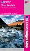
This is the information about the Hierarchy of Trails Routes for covering the OS Landranger sheet OS89 - West Cumbria, Cockermouth and Wast Water.
A4 map sections at 1:100,000 scale can be downloaded from here. The map sections are suitable for identifying the route accurately, and cross-referencing back to your own OS maps. We recommend that you print these out - and cross-reference back to your OS maps - but do not try to follow the route on the ground from these print outs.
Each survey sheet has grid references to help with route location. The survey sheets are indexed by:
- Byway Open to All Traffic (BOAT) number OR
- Unclassified County Road (UCR) number
You should use the A4 map sheets to confirm the location of the route, it's red / amber / green colour, and its route number. You should then look at the survey sheet to confirm precise grid references and addition survey information to be aware of. The # symbol, where it is printed on the map, means "refer to survey sheet".
In order to build on this information, we would greatly appreciate any feedback, either from recreational vehicle users, or landowners, farmers, local people, walkers, cyclists and horse-riders! You can contact us using the information below.
A4 maps and survey sheets
| Title | Date | Size |
|---|---|---|
| 16/04/2018 | 3549k | |
| 16/04/2018 | 4095k | |
| 16/04/2018 | 2414k | |
| 16/04/2018 | 1937k | |
| 4/10/2019 | 10k | |
| 4/10/2019 | 10k | |
| 10/01/2017 | 18k | |
| 10/01/2017 | 18k | |
| 10/01/2017 | 18k | |
| 10/01/2017 | 18k | |
| 12/01/2017 | 20k | |
| 10/01/2017 | 18k | |
| 10/01/2017 | 18k | |
| 10/01/2017 | 19k | |
| 10/01/2017 | 19k |